
The town’s main InfoBod
One clear information point for residents and visitors: important contacts, orientation, services, tips and the story of the place.
for example infobod.sk/podolinecA digital information network
InfoBod connects specific places with the information that visitors and residents really need — quickly, clearly and in context.

A clear structure
The project homepage introduces InfoBod. Each place has its own address, and its satellite points guide people directly to the relevant topic.
How it works
InfoBod follows the natural way people explore: first orientation, then a choice, and finally a specific answer.
One clear information point for residents and visitors: important contacts, orientation, services, tips and the story of the place.
for example infobod.sk/podolinecA QR code at a monument, an educational stop or a public service opens precisely the relevant section of the main InfoBod.
monuments, trails, services, storiesVisitors scan the QR code and the page opens immediately in their mobile browser. No app, registration or unnecessary steps.
also accessible through a regular linkThe visitor’s journey
The QR code is not the destination. It is a quiet signpost that leads people to useful content when they need it.
See the first InfoBodA town square, a monument, a trail or a public service.
No installation and no searching for the right page.
A short answer, a practical link or a gateway to the main InfoBod.
Who it is for
InfoBod brings order to content without taking away a place’s own character.
Practical information and local services in one place — for residents and visitors alike.
Stories, context and links right at the site, not only after returning home.
Clear points on the map, navigation and content that can grow with the project.
Responsible design
Readable typography, clear navigation, sufficient contrast and keyboard controls.
The basic information layer requires neither an account nor personal data. Data collection should always be justified and transparent.
Content remains easy to update, so important information does not turn into outdated signs along the way.
Each satellite leads back to the main InfoBod, so a detail never loses its place in the bigger story.
The first point on the map
A clear information point for essential information, a guide, a historical map, contacts and finding your way around town.
Open InfoBod PodolínecThe project vision
The network can gradually connect towns, municipalities, monuments, trails and small local points. Not as another app, but as a natural digital layer of public space.
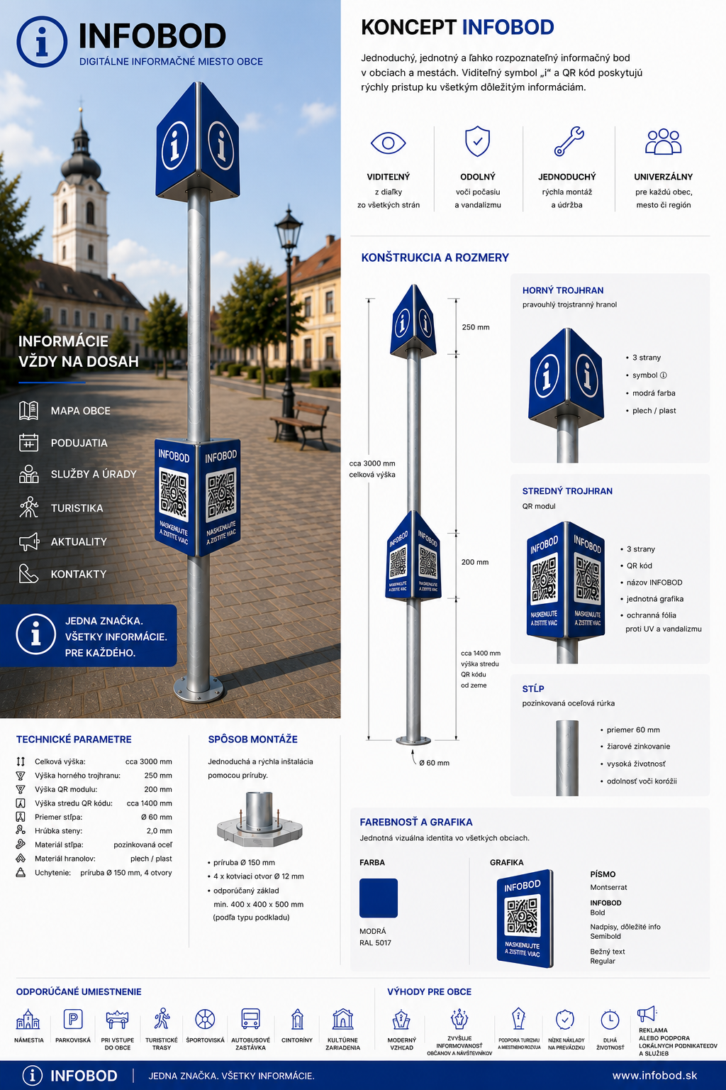 A concept for a physical InfoBod
InfoBod in public space
A consistent brand, a physical pillar or a smaller QR point gives information a clear address. People recognise it, scan the code and open precisely the information they need at that moment.
A town square, a village entrance, a bus stop, a cultural centre, a monument, a sports facility or a trailhead.
One visible point where visitors can access current services, events, orientation and local stories.
The exact dimensions, materials and signage are adapted to the character of the place — from a prominent pillar to a discreet QR point beside a monument.